Looking for the most beautiful place in the world to see aspen trees? Here are three of Colorado’s most spectacular autumn drives.
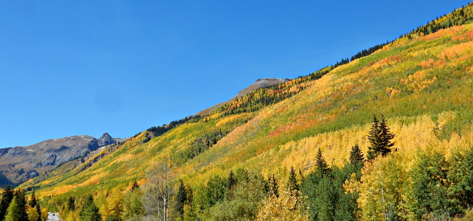
Aspen trees in Colorado in autumn
One of life’s bucket list experiences is seeing Colorado’s aspen trees in fall as they quake and burst into bright yellow with an occasional flurry of red or orange.
Crisscrossing the Colorado Rockies in mid-September through early October, you’ll see aspens in all their splendor, casting their beautiful reflections on lakes and rivers or blanketing 10,000-foot mountainsides with some of the richest fall colors outside of New England.
“Colorado in autumn is spectacular. There’s no other word to describe it,” said Mary Arlington, executive director of the Colorado Campground and Lodging Owners Association, which hosts CampColorado.com, the travel planning website.
Yet while there are more aspen trees in Colorado than any other place on Earth, there are a few choice routes where you’re bound to see some of the best fall colors and mountain scenery that the Centennial State has to offer. You’ll also find plenty of campgrounds along the way, many of which have rental accommodations if you don’t have a tent or RV.
Here are three of Colorado’s most scenic fall color routes with campgrounds that can be used as base camps along the way.
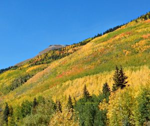
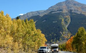
U.S. 550 from Durango to Ouray, the Switzerland of America
Aspen trees near Silverton Colorado
Also known as the “Million Dollar Highway,” the 70-mile stretch of U.S. 550 from Durango northward to Ouray is widely considered to be one of the most beautiful drives in the United States. On one end, it starts in the historic railroad town of Durango at 6,522 feet. You will see aspens blanketing mountainsides soon after leaving town. The road eventually climbs above timberline at 11,018-feet Red Mountain Pass. From there, you’ll descend again to the tiny 7,792-foot elevation town Ouray, which promotes itself as “the Switzerland of America.”
Before arriving at Ouray, most visitors stop to visit or stay in the historic mining town of Silverton. It’s at 9,318 feet in elevation and still has much of its original architecture from the late 1800s.
Ouray also has a beautiful historic district with buildings dating back to the late 1800s and early 1900s.
If your schedule allows, you might also consider taking a ride on the Durango and Silverton Narrow Gauge Railroad.
CAMPING
Campgrounds along and near this route include:
United Campground of Durango: This campground is located on the banks of the Animas River and the narrow gauge tracks run right through the middle of the park, creating an excellent photo op. Amenities include a heated swimming pool, a game room and a transit trolley to Durango.
Westerly RV Park in Durango: This property is across the street from the former Trimble Spa & Natural Hot Springs, which has new owners and has been renamed Durango Hot Springs Resort & Spa. The park is also close to the Dalton Ranch Golf Club.
Uncompahgre River RV Park in Olathe: This 29-acre campground is loaded with cottonwood trees and has one third of a mile of frontage along the Uncompahgre River.
Crested Butte to Carbondale via Kebler Pass and McClure Pass
This 73.5-mile scenic drive starts at one end at nearly 9,000 feet in elevation at Crested Butte. This historic coal mining town with more historic buildings dating back to the late 1800s. From there, follow County Road 12 for a spectacular 30-mile drive through aspen trees over 10,007-foot Kebler Pass. Many consider this pass to be one of the best places to view aspens in Colorado.
County Road 12 is a good quality gravel road, so it’s best to leave your RV in the campground and enjoy the aspen tour in the comfort of your car or truck.
Turn right when you reach State Highway 133, which will take you on 8 percent grades over 8,770-foot McClure Pass to Carbondale. McClure Pass includes views of the famous Maroon Bells mountain peaks near Aspen.
For a scenic side trip, as you head north to Carbondale, take County Road 3 for six miles to visit the tiny historic town of Marble. It’s located along the Crystal River. It’s famed for its high-quality marble, which was used in both the Lincoln Memorial and the Tomb of the Unknown Solider in Washington D.C. Marble is also the home of the famous Crystal Mill and the Yule Marble Quarry. It also serves as an entry point to the Maroon Bells / Snowmass and Ragged Wilderness areas.
CAMPING
Campgrounds along and near this route include:
Kebler Corner in Somerset: Situated along Anthracite Creek and the North Fork of the Gunnison River, this 6,300-foot elevation property offers luxury cabins of various sizes in addition to regular campsites.
Buena Vista to Aspen and Independence Pass
This breathtakingly beautiful pass is best done with the RV safely on a campsite at a nearby campground. It’s paved but no vehicles over 35 feet in length are allowed to travel this roadway, and the widths play a factor as well with some very limited clearances.
From Buena Vista, take U.S. Highway 24 north following the course of the Arkansas River to Twin Lakes, where you make a left and travel 37 miles on County Road 82 over 12,095-foot Independence Pass and down to the scenic 8,000-foot ski resort town of Aspen. (From Leadville, take U.S. Hwy 24 south, and turn right toward Twin Lakes.)
If you have time, you might also want to spend another day and head North on U.S. Highway 24 to the historic mining town of Leadville.
Buena Vista is also a popular base camp for ATV enthusiasts. Consider taking fall foliage tours using maps provided by the Buena Vista Welcome Center and Chamber of Commerce.
CAMPING
Campgrounds along and near this route include:
Chalk Creek Campground, RV Park & Cabins in Nathrop: This park offers RV and tent camping along Chalk Creek as well as furnished cabin rentals.
Mt Princeton RV Park & Cabins in Buena Vista: This park complements its RV sites with cabin and park model rentals. Amenities include a new clubhouse.
Sugar Loafin’ RV Campground in Leadville: This park complements its RV sites with park model rentals. The tent sites are large, and many are located under tall pine trees.
More Dream Trip Planning Ideas
Visit CampColorado.com to see numerous blog posts with helpful information to plan your dream trip to Colorado along with listings of hundreds of Colorado campgrounds.
CampColorado.com works closely with the Colorado Tourism Office, which hosts colorado.com, where you can find out about attractions and events all across the state. These two statewide travel planning websites will jumpstart your vacation dream list.

